
Multi-robot exploration can be a collaborative solution for navigating a large-scale area. However, it is not trivial to optimally assign tasks among agents because the state dynamically changes while the local observations of multiple agents concurrently update the global map. Furthermore, the individual robots may not have access to accurate relative poses of others or global layouts. We propose an efficient spatial abstraction for multi-agent exploration based on topological graph memories. Each agent creates a topological graph, a lightweight spatial representation whose nodes contain minimal image features. The information in graphs is aggregated to compare individual nodes and is used to update the similarity scores in real-time. Then, the agents effectively fulfill distributed task goals by examining the dynamic similarity scores of frontier nodes. We further exploit extracted visual features to refine the relative poses among topological graphs. Our proposed pipeline can efficiently explore large-scale areas among various scene and robot configurations without sharing precise geometric information.

At each time step, the agent traverses the scene and collects an RGBD observation and odometry sensor measurement as input. The agent also creates a node of a topological graph. Each node contains the RGBD observation, and the edge stores the relative pose between nodes, initialized by the odometry reading. Our proposed graph structure is designed to share essential information across different agents in real-time. Next, in the global goal planner, agents share topological graphs, which are then used to generate a similarity score map and also to help optimize the relative positions of deployed agents. Utilizing the collective graph information, the global goal planner offers high-level direction to the agents by assigning a long-term objective. Subsequently, the local planner generates the specific next-step actions needed to achieve the assigned global goal.

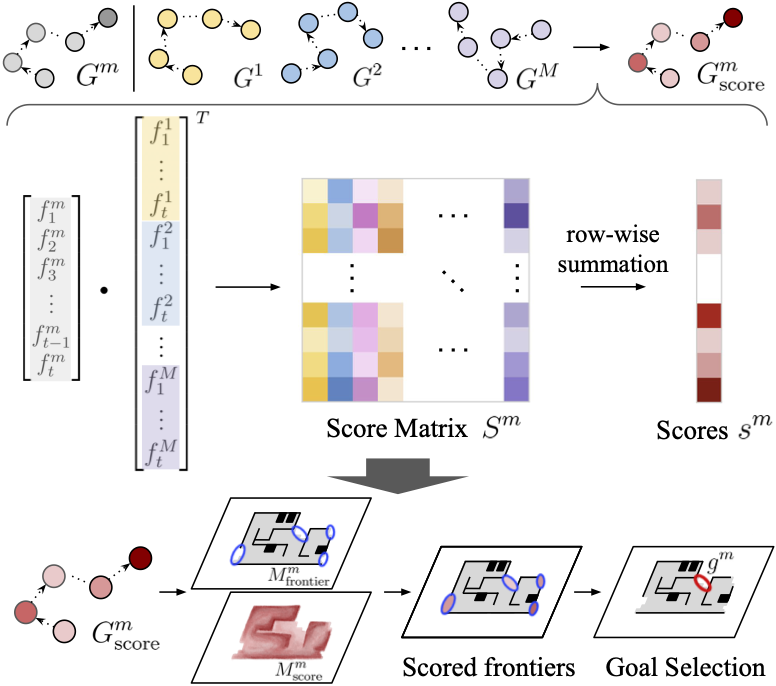
Our global planner estimates the frequency of agents’ visits within the mapped area. First, individual agents mark similarity scores for their observation nodes and generate score graph. To achieve the score graph, each node is passed through a pretrained encoder to extract similarity features. The inner product of these feature vectors is used to calculate a similarity score matrix. The summed scores for each node are then updated on the topological graph, resulting in a scored graph. From the score graph, two layers of maps are generated, the frontier map and the similarity score map. Lastly, the frontier with the lowest similarity score is selected as the final global goal.
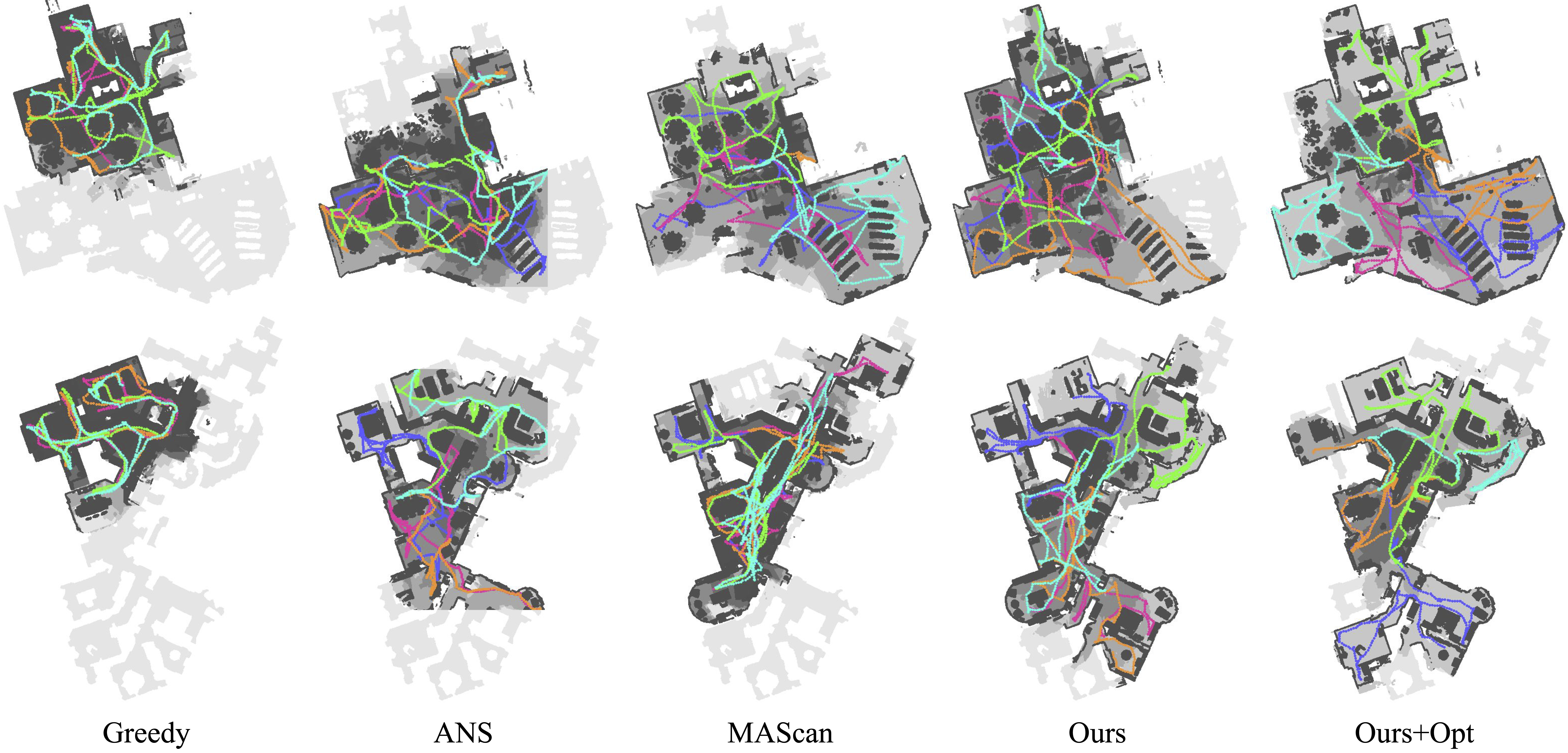
This video shows a demo of multi-agent exploration performance evaluated in the Habitat Simulator. Our suggested policy is compared with state-of-the-art approaches on a scene samples from the Matterport3D dataset. The reconstructed maps (gray) and each of the five agents' trajectories are visualized with different colors.